Ontario Fish ON-Line Interactive Zone Map, Explained
It's happened to all of us: you're planning an exciting fishing trip to a new lake or river in Ontario, only to be overwhelmed by the sheer volume of regulations. You flip through the printed summary, trying to match the species you want to target with the right zone, the correct season, and the specific daily limits, all while wondering if there are any special rules for that particular body of water. This confusion can easily lead to accidental violations and unnecessary stress. Thankfully, the Ontario Fish ON-Line Interactive Zone Map is designed to cut through that complexity, providing you with instant, location-specific regulations, and this guide will walk you through exactly how to use it.
Why Navigating Ontario's Fishing Regulations Can Feel Like a Maze
Let's be honest, trying to understand Ontario's fishing regulations can sometimes feel like you need a law degree and a cartographer's eye. The province is vast, and its waters are incredibly diverse, leading to a complex web of rules designed to protect our precious fish stocks. But for the average angler, this complexity often translates into frustration.
The Challenge of Traditional Regulation Summaries
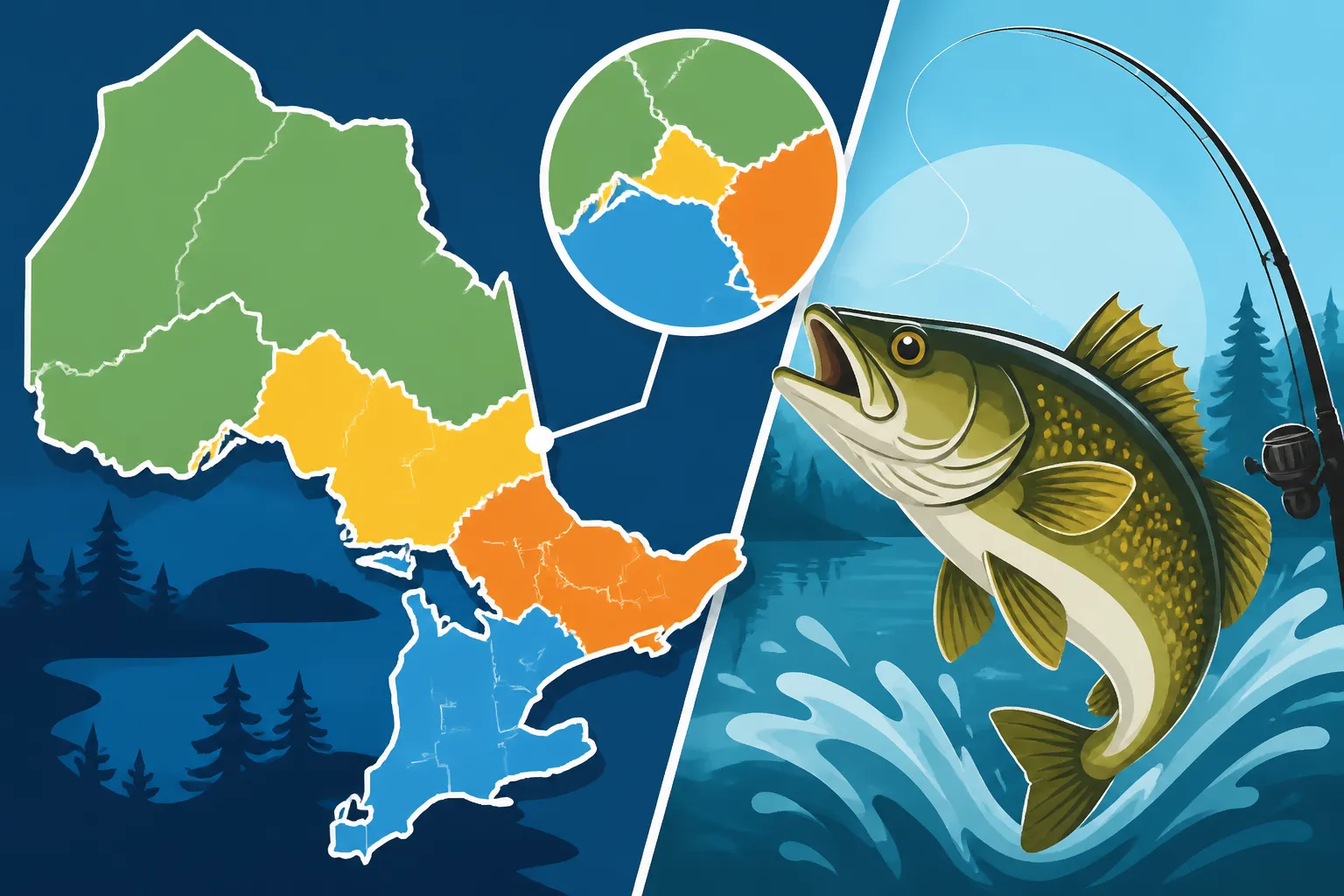
For years, the go-to resource has been the annual Ontario Fishing Regulations Summary, available as a booklet or a PDF online. While invaluable, these summaries require a significant amount of effort to use effectively. You first need to identify which of the 20 Fisheries Management Zones (FMZs) your chosen body of water falls into, then locate the specific species you're interested in, cross-reference the season dates for that FMZ, and finally, check the daily and possession limits.
What makes it truly challenging is when a lake or river has special regulations that supersede the general FMZ rules. You might find yourself flipping back and forth, trying to make sure you haven't missed a crucial detail. This process isn't just time-consuming; it's mentally taxing. It often leaves anglers second-guessing themselves, which is the last thing you want when you're trying to relax and enjoy the water. It’s no wonder many anglers find themselves wishing for a simpler way to stay compliant, and that's where the Fish ON-Line map truly shines.
The Risk of Misinformation and Fines
The stakes are higher than just a bit of confusion. Misinterpreting or simply being unaware of a specific regulation can lead to serious consequences. Imagine you've driven hours to a remote lake, finally land that trophy walleye, only to discover you were fishing out of season or that the lake has a catch-and-release only rule for that species. Not only is it heartbreaking, but it can also result in significant fines.
Conservation Officers are out there to protect our natural resources, and while they're often understanding, ignorance of the law is rarely an acceptable excuse. Fishing without a license in Ontario: Penalties are steep, and similar fines apply to violating limits, season dates, or special regulations. These aren't just minor penalties; they can quickly turn a fun day on the water into a very expensive and regrettable experience. This is why having an accurate, easy-to-use tool like the Fish ON-Line map is not just a convenience, but a critical safeguard for responsible angling.
What Exactly is the Fish ON-Line Interactive Zone Map?
In response to the very challenges we just discussed, the Ontario Ministry of Natural Resources and Forestry (MNRF) developed the Fish ON-Line Interactive Zone Map. Think of it as your personal, digital regulations assistant, designed to make understanding Ontario's vast fishing rules as straightforward as possible.
More Than Just a Map: A Regulatory Hub
At its core, Fish ON-Line isn't just a pretty map displaying lines and waterbodies. It's a sophisticated online platform that consolidates an incredible amount of regulatory data into one interactive, user-friendly interface. Instead of just showing you where the lakes and rivers are, it pulls information directly from the official Ontario Fishing Regulations Explained and applies it geographically.
This means when you click on a specific spot on the map, you're not just seeing its name; you're accessing a dynamic database that retrieves all the relevant rules for that precise location. It includes everything from general provincial regulations to the highly specific, often overlooked, local restrictions that apply to particular lakes, rivers, or even sections of rivers. It’s the MNRF's official digital tool to ensure anglers have the most current and accurate information at their fingertips.
How It Simplifies Complex Regulations
The true magic of the Fish ON-Line map lies in its ability to simplify what would otherwise be a laborious cross-referencing task. Instead of needing to know the Fisheries Management Zone number, then scanning through pages of text, the map performs all that heavy lifting for you.
Imagine you're thinking of fishing Lake Nipissing. Traditionally, you'd find Lake Nipissing in the summary, identify it as being primarily in FMZ 11, then go to the FMZ 11 section to find the walleye season, the pike limits, and so on. With Fish ON-Line, you simply navigate to Lake Nipissing on the map, click on it, and voilà – a pop-up window instantly displays all the relevant species, their open seasons, and the corresponding daily and possession limits for that specific lake. If there are any special regulations for Lake Nipissing, they are prominently displayed right alongside the general FMZ rules, eliminating the guesswork and the risk of overlooking critical details. It truly streamlines the process, making responsible angling more accessible to everyone.
Getting Started with the Fish ON-Line Interactive Map
Ready to ditch the paper summary and embrace the future of fishing regulation lookup? Getting started with the Fish ON-Line Interactive Map is quite straightforward. It’s designed to be intuitive, even for those who aren’t particularly tech-savvy.
Accessing the Map Online
The Fish ON-Line map is a web-based application, meaning you don't need to download any special software or an app to use it. All you need is an internet connection and a web browser on your computer, tablet, or smartphone.
To access it, simply open your preferred web browser and search for "Ontario Fish ON-Line" or navigate directly to the Ontario Ministry of Natural Resources and Forestry (MNRF) website. Look for a section related to fishing or regulations, and you'll find a prominent link to the interactive map. The MNRF frequently updates its website, but the link is usually easy to spot under "Fisheries" or "Recreational Fishing."
Once you click the link, the map interface will load in your browser. Give it a moment, especially if you have a slower internet connection, as it's pulling in a lot of geographic and regulatory data. There's no login required, no account to create – it’s a public resource available to all anglers, whether you have an Ontario Fishing License Guide for 2026 or are just curious about the rules.
Understanding the User Interface
When the map loads, you'll see a layout that's familiar if you've ever used online mapping services like Google Maps. Here are the key elements you'll encounter:
- Map Display: This is the central pane showing Ontario's lakes, rivers, and landscape. You can pan (click and drag) to move around and zoom in or out using the scroll wheel on your mouse, or the +/- buttons typically found in a corner of the map.
- Search Bar: Usually located at the top or in a side panel, this is your quickest way to find a specific body of water. You can type in the name of a lake, a river, or even a town near your fishing destination.
- Legend: Often toggleable, the legend explains what the various colours and symbols on the map represent. This is especially important if you're exploring different layers (which we'll cover next).
- Layers and Tools: Typically found in a sidebar or as icons, these allow you to customize what information is displayed on the map. You can toggle on or off things like Fisheries Management Zones, stocking locations, or boat launches.
- Pop-up Information Windows: This is where the magic happens. When you click on a specific lake or a section of a river, a window will pop up, displaying all the relevant fishing regulations for that exact spot.
Take a few minutes to play around with these controls when you first open the map. Zoom in on your home lake, pan around your region, and try a few searches. The more comfortable you are with the interface, the more effectively you'll be able to use it to plan your next fishing adventure.
Mastering the Map's Features for Smarter Fishing
Once you're familiar with the basic interface, you can start to really leverage the power of the Fish ON-Line Interactive Map. This tool isn't just about avoiding fines; it's about empowering you to be a more informed and strategic angler.
Pinpointing Your Specific Fishing Location
The first step to unlocking regulations for your spot is to find it on the map. You have a couple of excellent options for this:
- Using the Search Bar: This is often the quickest method if you know the name of the lake, river, or even a nearby town. For instance, if you're planning a trip to the Bay of Quinte Walleye Fishing hotspot, simply type "Bay of Quinte" into the search bar. The map will usually zoom directly to that location. You can also try searching for "Grand River Paris" or "Lake Erie" to pinpoint larger bodies of water. The accuracy is generally excellent, pulling up even smaller, less-known lakes if you spell their names correctly.
- Panning and Zooming: If you prefer to explore or don't know the exact name, you can pan and zoom just like any other online map. Start by zooming into the general region of Ontario you're interested in, then slowly pan across the landscape until you spot your target waterbody. This is a great way to discover new potential spots or get a broader understanding of the geography of a particular Ontario Fisheries Management Zones, Explained.
Once you've found your spot, simply click on the lake, river, or even a specific section of a river that you plan to fish. A detailed information window will then appear, displaying all the regulations pertinent to that precise location.
Deciphering the On-Screen Regulations
When that information window pops up after you've clicked on a waterbody, it's packed with crucial details. Don't be overwhelmed; it's designed to be comprehensive. Here's what you'll typically see:
- Species List: A clear list of common fish species found in that waterbody, such as Walleye, Northern Pike, Smallmouth Bass, Lake Trout, etc.
- Season Dates: For each listed species, you'll find the specific open and closed season dates. This is incredibly helpful, especially for species with varied openers like Ontario Walleye Opener Dates by Zone, which can differ greatly even within adjacent FMZs.
- Daily Catch Limits: This tells you how many fish of a particular species you are allowed to keep in a single day.
- Possession Limits: Often different from the daily limit, the possession limit indicates the maximum number of fish you can have in your possession at any time, whether fresh, frozen, or otherwise stored. This is outlined in more detail in Ontario Bag and Possession Limits by Species.
- Special Regulations: This is arguably the most critical section. It will highlight any unique rules that apply only to that specific waterbody, overriding or adding to the general FMZ regulations. This could include minimum/maximum size limits (slot limits), gear restrictions (e.g., "no live bait fish"), or even "catch and release only" designations for certain species or areas. These Special Regulation Waters in Ontario are often easily overlooked in the printed summary but are highlighted clearly on the map.
Here’s a simplified example of the type of information you might see when clicking on a waterbody:
| Species | Season Dates | Daily Limit (Sport/Conservation) | Possession Limit (Sport/Conservation) | Special Regulations |
|---|---|---|---|---|
| Walleye | Open Jan 1 – Mar 15, May 15 – Dec 31 | 4 / 2 | 4 / 2 | None |
| Northern Pike | Open Jan 1 – Mar 31, 2nd Sat May – Dec 31 | 6 / 2 | 6 / 2 | None |
| Smallmouth Bass | Open 4th Sat June – Nov 30 | 6 / 2 | 6 / 2 | Min. size 30cm (11.8 in) |
| Lake Trout | Open Jan 1 – Sept 30 | 2 / 1 | 2 / 1 | Barbless hooks only during ice fishing season |
| Brook Trout | Open 4th Sat April – Sept 30 | 5 / 2 | 5 / 2 | Catch and Release only in designated tributaries |
Note: This table is illustrative and does not represent actual regulations for any specific waterbody. Always check the official Fish ON-Line map or regulations summary.
Utilizing Layers and Filters
Beyond the basic waterbody information, Fish ON-Line offers additional layers that can enhance your planning and on-the-water experience. Look for icons or a menu item labeled "Layers" or "Map Contents."
Common layers you might find include:
- Fisheries Management Zones (FMZs): This layer overlays the boundaries of Ontario's 20 FMZs directly onto the map. While the map simplifies things, seeing the FMZ boundaries can still be helpful for understanding the broader regional context of Ontario Fisheries Management Zones, Explained.
- Stocking Locations: For those who enjoy targeting stocked fish, particularly trout, this layer is invaluable. It shows where the MNRF has stocked various species, helping you locate potential hotspots for List of Ontario stocked trout lakes or rivers.
- Boat Launches: This layer highlights public access points and boat launches, which is incredibly useful when planning your trip, especially to larger lakes where access can be limited. Don't forget to review Ontario Boating Laws for Anglers before heading out on the water.
- Dam Locations: Useful for understanding river systems and potential fish migration barriers or tailwater fishing opportunities.
By toggling these layers on and off, you can customize the map to display the most relevant information for your specific needs, making it a truly powerful planning tool.
Practical Scenarios: How Fish ON-Line Helps Real Anglers
The Fish ON-Line map isn't just a theoretical tool; it's incredibly practical for everyday fishing scenarios, saving you time, frustration, and potential legal troubles.
Planning a Trip to an Unfamiliar Lake
Let's say you've heard whispers about fantastic fishing on a lake in Northern Ontario, perhaps somewhere in the Temagami area, and you're planning a multi-day adventure. Traditionally, you'd spend hours cross-referencing maps with the bulky regulations summary. With Fish ON-Line, the process is streamlined:
- Search: You type in the lake's name. The map instantly zooms in.
- Click & Review: You click on the lake. The pop-up window immediately displays the species present (say, Walleye, Northern Pike, Lake Trout), their specific season dates (Ontario Fishing Season Dates by Zone), and daily/possession limits. You instantly know that Lake Trout is open until September 30th, but Walleye has a specific closed period in March and April.
- Check Special Rules: You quickly scan for any unique rules. Perhaps this lake has a "catch and release only" policy for Smallmouth Bass, or a slot limit for Walleye that you wouldn't have known from the general FMZ rules.
- Plan Gear: Armed with this precise information, you can confidently pack the right gear and plan your itinerary, knowing exactly what you can target and when. No more guessing or hoping you've got it right.
This capability is particularly vital when dealing with unique regional challenges, such as the Ontario Aurora Trout Rotational Lake Closures, where specific lakes are closed on a rotating basis to protect this rare species. The map provides instant clarity.
Checking Regulations on the Water
Even the best-laid plans can change. You might be out on the lake, fishing for Walleye, and unexpectedly stumble upon a new bay that looks perfect for Northern Pike. Before you cast, you can quickly verify the regulations right from your boat or shore.
Most modern smartphones and tablets can access the Fish ON-Line map via their web browser, provided you have a decent cellular signal. Simply pull up the map, use your device's GPS to show your current location (if available and enabled), or manually pan to the new area, click on the water, and confirm the pike season and limits. This on-the-spot verification can prevent an honest mistake that could lead to a fine.
To protect your device while on the water, consider investing in a waterproof phone case or a waterproof dry bag. You can find excellent, durable options for these on Amazon, ensuring your device stays safe from splashes or an accidental dip in the lake. While you can always take screenshots of regulations before you head out, having live access is often a lifesaver. Keep in mind that for remote areas with no signal, pre-saving the information is crucial. For longer trips, a portable power bank, also readily available on Amazon, is an absolute must-have to keep your devices charged.
Understanding Special Regulation Waters
Ontario has numerous "Special Regulation Waters" – lakes, rivers, or even sections of rivers that have rules deviating from the general Fisheries Management Zone regulations. These are put in place for various reasons, such as protecting vulnerable fish populations, managing specific fisheries, or providing unique angling experiences.
For example, some rivers might be "fly fishing only" in certain stretches, or have "catch and release only" rules for certain species like native Brook Trout. These nuanced rules are notoriously easy to miss in a printed summary unless you know exactly where to look.
The Fish ON-Line map clearly highlights these special regulations directly in the information pop-up when you click on the affected waterbody. This ensures that you're immediately aware of any restrictions on gear, bait, or retention limits that apply to your chosen spot. This feature is a game-changer for avoiding unintentional violations and ensuring you're respecting the specific conservation efforts in place for sensitive fisheries.
Tips for Getting the Most Out of Fish ON-Line
The Fish ON-Line map is a fantastic resource, but like any tool, knowing a few best practices can significantly enhance your experience and ensure you're always prepared.
Best Practices for Mobile Use
Using the map on your smartphone or tablet while actually fishing can be incredibly convenient, but it comes with a few considerations:
- Connectivity is Key: Remember, Fish ON-Line is a web application. You'll need an internet connection to access the most up-to-date information. While many populated areas have good cell service, remote fishing destinations might not.
- Plan Ahead for Remote Areas: If you're heading somewhere without reliable cell service, it's a smart move to look up your intended fishing spots and their regulations before you leave. You can take screenshots of the regulation pop-ups or even print out the relevant sections of the map if you prefer a physical copy.
- Power Management: Prolonged use of your mobile device, especially with GPS enabled, will drain its battery quickly. Always carry a fully charged portable power bank. There are many robust, waterproof models available on Amazon that are perfect for outdoor adventures.
- Protection: Water and electronics don't mix. Ensure your phone or tablet is in a waterproof case or stored in a reliable dry bag when on the water. Again, Amazon offers a wide selection of protective gear for your electronics, from simple pouches to rugged cases.
Cross-Referencing with the Official Summary
While the Fish ON-Line map is incredibly powerful and typically provides the most current information, it's always a good habit to understand the broader context. Think of the map as your quick-reference guide, and the full Reading the Ontario Fishing Regulations Summary as your comprehensive legal text.
The summary contains important definitions, general provincial rules that apply everywhere (like how to measure a fish or what constitutes valid bait), and often more detailed explanations of complex regulations. For nuanced situations or if you ever have a lingering doubt, consulting the official summary can provide additional clarity and context that a compact map pop-up might not fully convey. It's about being well-rounded in your understanding, not just relying on a single source.
Keeping Up-to-Date
Ontario's fishing regulations are dynamic. They are reviewed and updated annually by the MNRF to adapt to changing fish populations, environmental conditions, and conservation needs. This means that the rules for a specific lake or species could potentially change from one year to the next.
One of the significant advantages of the Fish ON-Line map is that it is typically updated in real-time as regulations change. This means it reflects the most current information available from the MNRF. Therefore, before every fishing trip, especially at the start of a new season or if you're visiting a new area, make it a habit to check the Fish ON-Line map. A quick five-minute check can ensure you're operating under the correct rules and avoid any surprises that might have changed since your last outing. This diligence ensures you're always fishing legally and responsibly, contributing to the sustainable future of Ontario's fisheries.
Disclaimer
The information provided in this guide is for general informational purposes only and is based on publicly available information about the Ontario Fish ON-Line Interactive Zone Map. While efforts have been made to ensure accuracy, regulations can change. Always consult the official Ontario Fish ON-Line Interactive Zone Map and the current Ontario Fishing Regulations Summary from the Ministry of Natural Resources and Forestry (MNRF) before heading out to fish to ensure compliance with all applicable laws and regulations.